
COOK — The banks of the Little Fork River have flooded downtown roads, businesses and homes after Tuesday's storm, which caused flooding and washed out roads from the Iron Range to Wisconsin's Bayfield County.
It likely hasn't peaked yet.
ADVERTISEMENT
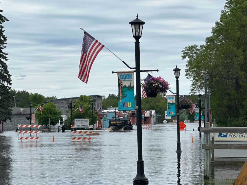
"Our farm is fine. We're on a hill," said Lois Pajari, owner of Cook's Country Connection petting zoo in Cook. "But our community is in trouble."
Pajari said there is waist-deep water in some locations, and she's heard of basements completely full of water up to the home's main level.
But residents are helping each other out.
Pajari said she was loading gravel from a pit at midnight Thursday so volunteers could fill sandbags, and she's caring for a flock of chickens for someone who had to evacuate their home Wednesday. "Everybody's sticking together and doing what we can to save what we can," Pajari said.
Cook, MN is facing major inundation from a swollen Littlefork River. The water level continues to gradually rise. The headwaters of this river were in the heaviest rainfall bullseye last night. Residences and businesses are surrounded with water. @NWSduluth @MPRnews #mnwx pic.twitter.com/8PWPvMztBx
— Ketzel (@quetzallevens) June 19, 2024
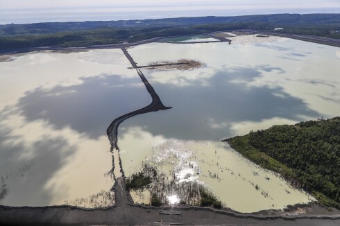
While there was initial flash flooding in Cook during Tuesday's storm — 4.2 inches of rain fell just north of Cook, according to the National Weather Service — the headwaters of the river near Lake Vermilion saw some of the highest amounts of rain, causing the river to flood in late afternoon Wednesday and keep rising overnight.
Ketzel Levens, meteorologist and a co-manager of the hydrology program at the National Weather Service Office in Duluth, said the 7.6 inches of rain that fell near Tower and the headwaters took some time to reach Cook.
"All of that water is finally able to work its way through our water systems — through those little creeks and rivers — that's when we start to get that convergence of all that water that was leading to overland flash flooding concerns, (and) now is turning into riverine flooding in those community that are in low-lying areas along rivers," Levens said.
ADVERTISEMENT
Water levels on the Little Fork River at Linden Grove, approximately nine miles west of Cook, continue to rise. As of 8:45 a.m. Thursday, the river reached 38.82 feet, 8 feet higher than before Tuesday's rain, according to the National Water Prediction Service.
More photos from Cook, MN yesterday evening. Water was actively rising at this time and is higher this morning. @MPRnews @DanWolfeKBJR @DanHanger @CathyWurzer pic.twitter.com/UgXjgRhg3C
— Ketzel (@quetzallevens) June 20, 2024
"The rate of rise doesn't appear to be slowing just yet," Levens said. "So we aren't seeing any indication of it turning over or at least peaking today. I would expect probably sometime in the next couple of days."
More rain is on the way, but the heaviest amounts are expected to fall on central and southern Minnesota, Levens said.
According to the National Weather Service, another half-inch to an inch of rain could fall on Cook between Friday afternoon and Saturday evening.
"Any additional rain, what that's going to lead to is just a longer period of that high water and the recession rate being slower," Levens said.